

Saving A One to Many 'Join' in QGIS
15 Jun 2018When A Relate Won’t Do
While working on the next part of my series of blogs I ran into an interesting ‘discovery’ which warrants an interjection. Testing the data loads into a geopackage, I decided to join a spatial and attribute data AND retain the results as a new ‘layer’. Tools in the QGIS Processing didn’t help much. So I Googled for a solution. To my surprise I got a few first time hits. I learnt MapInfo can do it so can ArcMap. There we also suggestions of having a relate in QGIS. But, that’s not what I sought.
Buried in a Google Forum was the solution by Thomas McAdam. So here’s how I ended up doing it … so we have one more source for the solution on the web.
Love The Database
A pre-requisite to the procedure is to have the data stored in some database and that’s not scary at all. I explain one way to doing that here creating a Geopackage. You can also create a SQLite Database as explained here. You don’t even have to leave the comfort of Q while doing it.
A One To May (1-M) Join
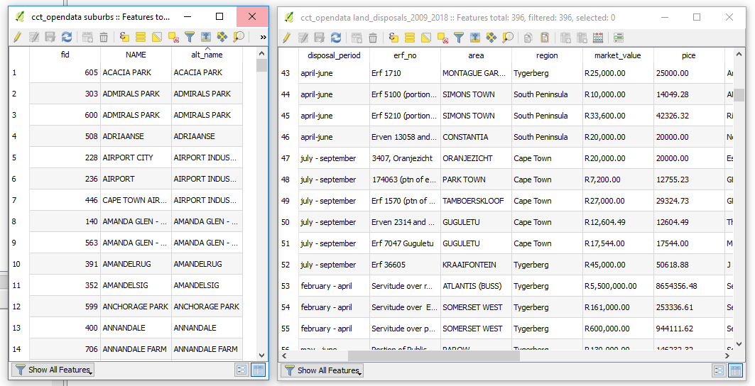
With the objective of joining two datasets and keeping the results. The assumption is that your data is clean and you have common fields between your two datasets.
- Table 1: suburbs - Has polygons of suburbs I wish to join (One Record).
- Table 2: land_disposals_2009_2018 - which has sales records per suburb (Many Records).
Now, with the target datasets loaded in a ‘spatial database’ as suggested above.
-
From within Q, Launch DB Manager to access the geopackage (in my case, explained here.)
- Select the appropriate database/ geopackage then
- Launch the SQL Window.
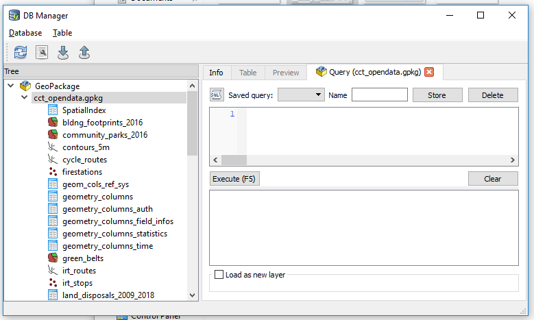
- Within the window write SQL Statement to JOIN our suburbs with the land_disposals_2009_2018 table.
Which translates to
SELECT  *
FROM suburbs
JOIN land_disposals_2009_2018
ON suburbs.alt_name = land_disposals_2009_2018.area;
Simply put this says, “Basing on the common valued fields alt_name and area of the suburbs and land_disposals_2009_2018 layers respectively, join these two.”
-
Click on Execute to see what results this gives. (An inspection will help verify the legitimacy of the operation we just ran.)
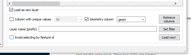
- Tick the Load as new layer Check Box near the bottom of the SQL Window.
-
Tick the Geometry column Check Box. (Selecting a value that looks/ read something like geom).
- Now click on Load now! to have the results display in Q.
Results, If You Please.
On clicking Load Now! The Q canvas will fill with spatial, familiar ground!
To Save the results, Right Click the layer name in Q, Save As and we can save to any format supported by Q to our heart’s content.
#PostScript
The JOIN used here is an overly simplified approach to tip-top SQL queries. I would recommend intensive reading up on the JOIN operation as things can really go wrong surreptitiously.